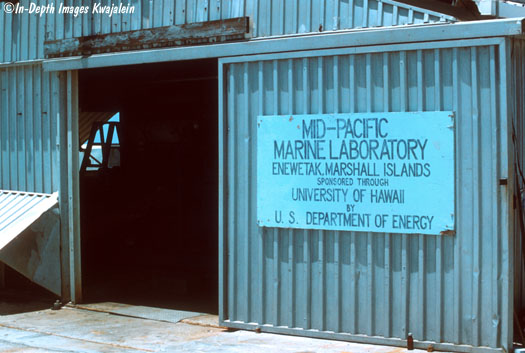
In 1954, while the US was in the midst of testing nuclear weapons in the northern Marshall Islands, came the establishment of a marine biological laboratory at Enewetak Atoll. Originally this was called the Eniwetok Marine Biological Laboratory, and was typically active during the testing programs. After nuclear testing in the Marshalls ended in 1958, the lab was generally staffed only part of the year until 1974, when the lab began to be staffed full time and was renamed the Mid-Pacific Marine Laboratory. Over the next few years, the lab was used by many visiting scientists with the support of the lab staff. In 1979, the name changed again, this time to the Mid-Pacific Research Laboratory and was run by a full-time research staff. Visiting scientists still came out to do research, but that was over and above the basic work that was being done at the lab. One summer we even had the submersible Makali'i from the Hawaii Undersea Research Laboratory come out to spend a few months doing dives on the seaward reefs, the lagoon bottom, and the bottoms of some of the thermonuclear test craters.
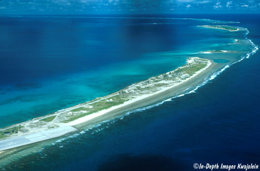
The last few years of its existence, the lab occupied what had formerly been a US Coast Guard Loran station situated on the northern tip of Enewetak Island in the southeastern part of the atoll, seen in the aerial photo below of the northern portion of the island.
The lab is at the very northern tip. Just to its right on the reef flat is a patch that is greener than the surrounding reef. This is a quarry, created to mine aggregate from the reef for concrete construction, probably during the testing days. During the last years of the lab, this quarry, perhaps 3 meters deep at the deepest, was a lush garden of coral and sand patches, and was occupied by one large giant clam, Tridacna gigas, that had been placed there at a much smaller size and measured throughout the years.
The main lab building was an air-conditioned aluminum structure that housed most of the scientific equipment, communications equipment, library, and scientific collections, along with the computer center--and in 1981 through 1983, the latter consisted of a single Radio Shack TRS-80 computer with storage provided by a cassette tape drive. Power to the lab complex was provided by a couple of large generators just inside this door on the south end of the lab building.
Turned out one of the big reasons the bean counters at the US Department of Energy finally shut down the lab in 1983 was the cost of shipping out the fuel that kept those generators running. The rest of the atoll had no formal power generation; there were just a few private small generators owned by individuals to run lights or refrigeration and these were not consistently running.
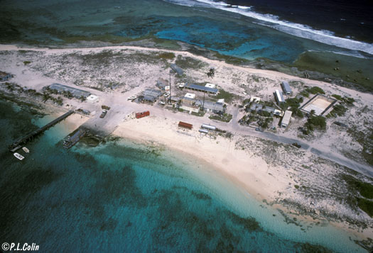
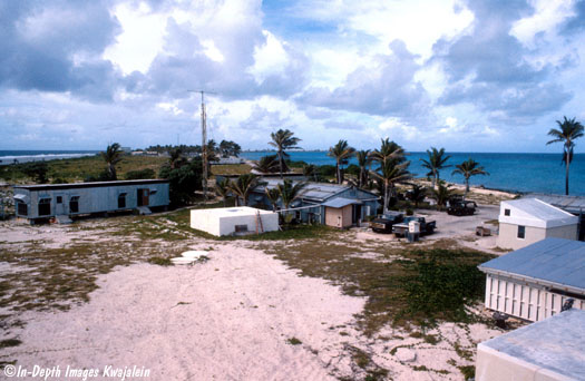
Aside from the lab itself, the generators ran the plumbing, both fresh water (rainwater collected from the complex roofs and stored in four square concrete tanks) and sea water. A marine biological lab must have running sea water, was provide to a separate structure called the wet lanai that contained numerous aquaria and sea tables, shallow, elongate wood and fiberglass boxes that sea water ran through continuously. The flowing sea water was provided by a pump located about midway in the hundred meters or so that separated the lab complex from the seaward reef flat and quarry. The pump, in a small shed, pumped water from the quarry, pushing it up into a tank that sat on a small tower and gravity fed the wet lanai. The tower was also useful for getting a vantage point for photos of the lab complex. In the first shot from the tower below, there is a square white water tank in the foreground that collected rainwater that fell on the roof of the wet lanai, the elongate building with the white slated wall facing us. Beyond that is the main lab building, also with a white water tank to collect its rainwater. Off to the right side beyond the boats is a maintenance shop.
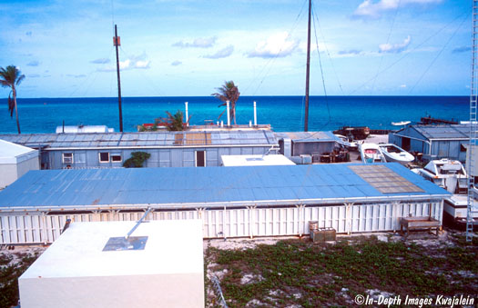
Panning left from above, we see the end of the wet lanai at far right in the lower part of the photo. Just beyond this is a beige building with a slanted white roof (also for collecting water) that housed the scuba air compressor and tanks. Just left of center is another white water tank, this one collecting water from the visiting scientists dorm just to the right of and behind the tank. Only barely visible behind that is the kitchen trailer for food storage and preparation. The lab was supplied by approximately quarterly visits from a DOE chartered vessel called the Liktanur and based at Kwajalein, and received its "fresh" fruits and vegetables on Airline of the Marshall Islands flights from Kwajalein every other week--at least theoretically. Behind and to the left of the water tank is one of the living trailers that housed the scientific staff.
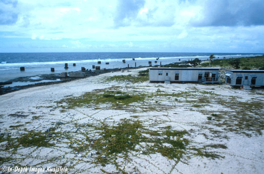
Panning farther left we see another living trailer for scientific staff. These trailers were nothing more than places to sleep. They were not air conditioned, and the only way they could be livable was by having louvered windows that were always open to let a breeze come through. This also let a perpetual mist of salt air through the entire trailer, which got on everything. We figured it was a plot to encourage the staff to spend most of their time in the lab, which along with the kitchen trailer were the only air-conditioned buildings in the complex. Out on the reef to the left of the trailer are a bunch of large concrete blocks that had been used to anchor the guide wires that held up the Coast Guard Loran tower. The living trailer partly visible on the right side below is the same one seen at far left in the photo above. Together these give an idea of the width of the island here. Not too wide.
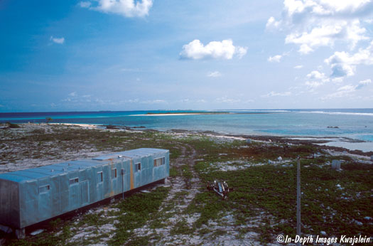
Turning around to look north, we see the north end of the island and shallow intertidal reef between Enewetak and the first small island, known on the charts as Bokandretok. The trailer at lower left is a workshop; one project that came out of it was an ultralight aircraft built by the lab's chief scientist and flown away by him when the lab closed down in 1983.
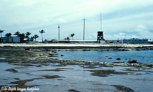
From the seaward reef flat at low tide, we can see the quarry in the foreground and the lab complex on the island. The water tower from which the photos above were taken is just right of center.
A boat ramp and small pier were on the lagoon shore next to the lab.
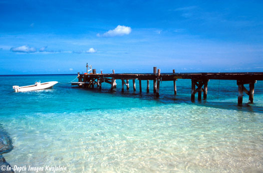
The summer storm of 1982 took out this old wooden pier, but a few months later a team came out to build one with steel supports.
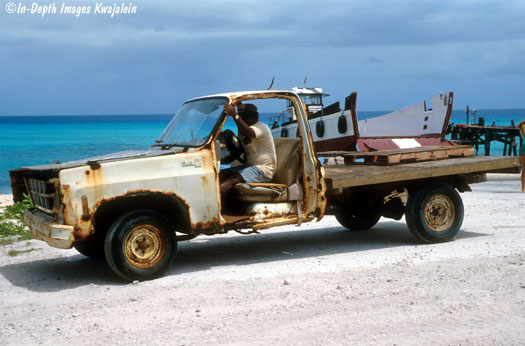
Naturally given our esteemed status within the Department of Energy, the lab was supplied with modern, state-of-the-art equipment. The landing craft hauled out of the water behind the pristine truck represents another interesting experience.
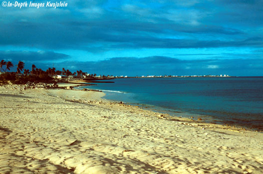
Just a few meters from the lab's front door was the lagoon beach. Many nudibranchs lived beneath the rocks in shallow water just off the beach here.
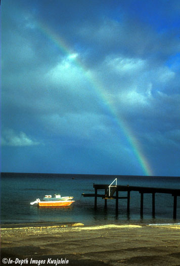
Looks idyllic, doesn't it? But conditions could change. We got caught almost by surprise by summer storm waves in 1982. In November of that year, we had a few hours' warning to prepare for typhoon Pamela.
Press the back button to return to the Enewetak Atoll page.
![]()